Category Archives: Floodplain Management

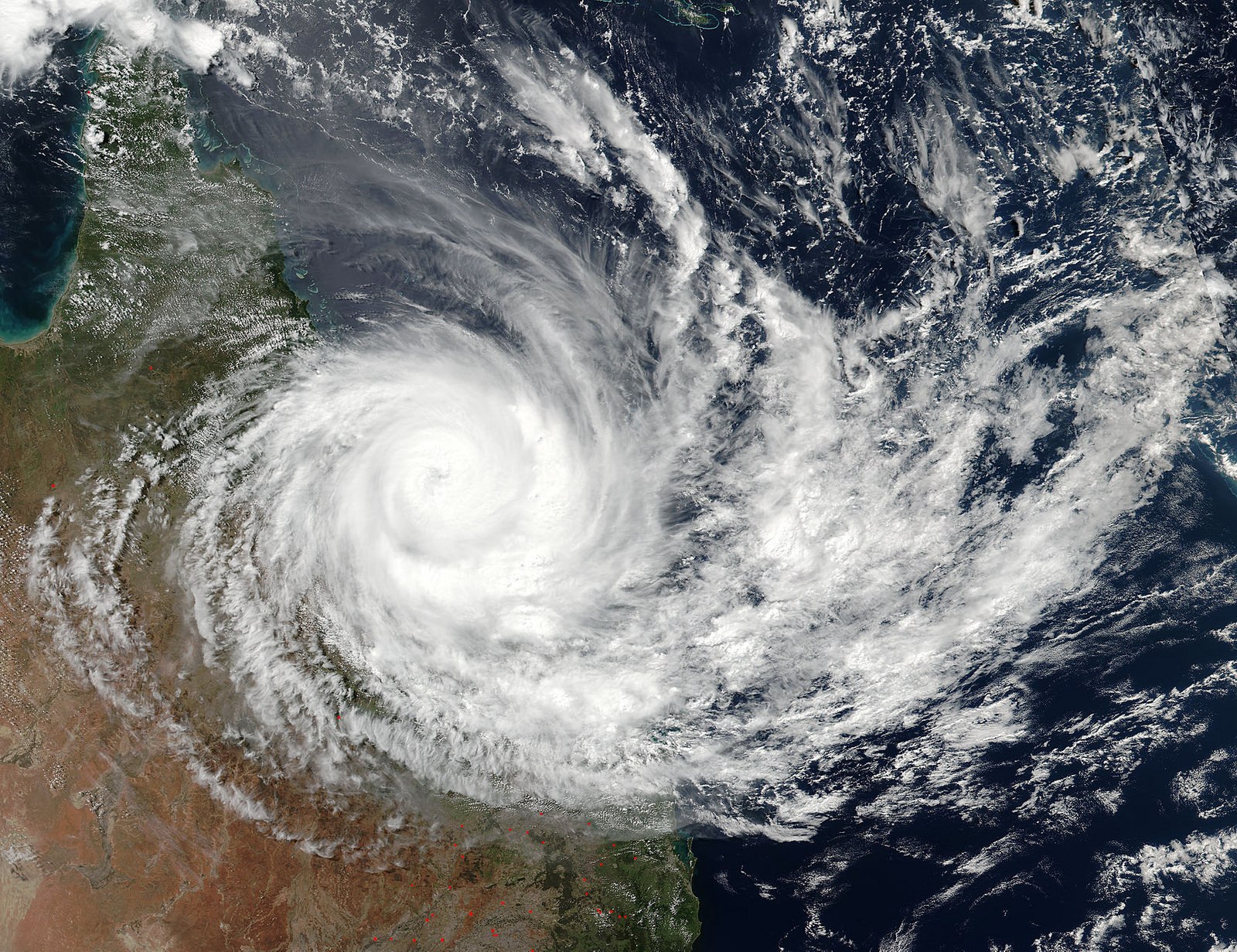
Photo of TC Debbie

Flood Community Education & Awareness

This critical aspect of floodplain management is really being overlooked as probably the key tool in reducing the impact of flooding overall (outside of prevention/structural mitigation etc.)  And in my view, it is done quite poorly.

The first steps to increasing awareness in the community is simple things like developing websites with flood awareness information.  But in all honesty, I’m continually asked by members of the community to still interpret this information – people just don’t understand it.  So in that regard, we cant simply push information to a portal and wipe our hands- job done.

What we need is largescale community education campaigns that are face to face.  This is missing.  Whilst its not possible or practical to undertake face to faced education and consultation for all flood affected community members, I believe it absolutely should be for high flood risk residents.

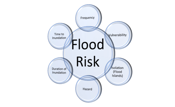
When I say flood risk, I don’t just mean impacted by flooding I mean a combination of factors leading to a resident being high flood risk which could include:

  • Community members that are vulnerable (low awareness, social issues, disabilities etc.). We can use census information and local intelligence to target these members and in addition tailor our engagement techniques to suit different vulnerabilities.
  • High hydraulic risk. A combination of high flood frequency and high flood hazard leads to significantly increased flood risk.  We can use outputs of flood models in this way to further prioritise residents for face to face engagement.
  • Other factors such as flood warning time and length of flood inundation. This might involve educating residents on where they live, what type of flooding they might encounter.  In addition, some residents may live on high flood islands and be surrounded (but not inundated) by flood waters for many days.  This information and understanding may help residents have additional mechanisms to deal with this threat (back up supplies, emergency kits etc).

There is a push more to make the community responsible for themselves and their own actions.  And the reality is, this is somewhat necessary.  But we cant do that without equipping the community with the information they need and this requires extensive investigation and implementation at a face to face scale.  Other techniques like educating community groups and champions can also be a powerful way for bottom up education and resilience in the community.  We need the bottom up and top down education campaigns together.

Contemporary approaches to FM planning consider these aspects, and it is important to have professionals involved in this space that have an understanding of all the elements and mitigation techniques for FM planning.

An approach such as this can help authorities priortise limited resources into the areas needed.  Couple with advanced flood impact based intelligence and forecasting systems, this can also provide innovative ways to undertake a risk based approach to managing flooding.

This is an evolving space in floodplain and emergency management, and as the tools, techniques and technology improve, we can get better at managing our flood risk with multiple tools.

Flood Risk Evolution

Flood risk assessment and management is evolving throughout latest contemporary floodplain management plans that we have been involved on delivering in QLD.  Throughout the process of several recent major projects, the Brisbane River Strategic Management Plan has established some form of consistency to be applied across multiple catchments.  The latest Council local floodplain management plans (across entire jurisdictions) have gone to the next level in latest thinking and application.

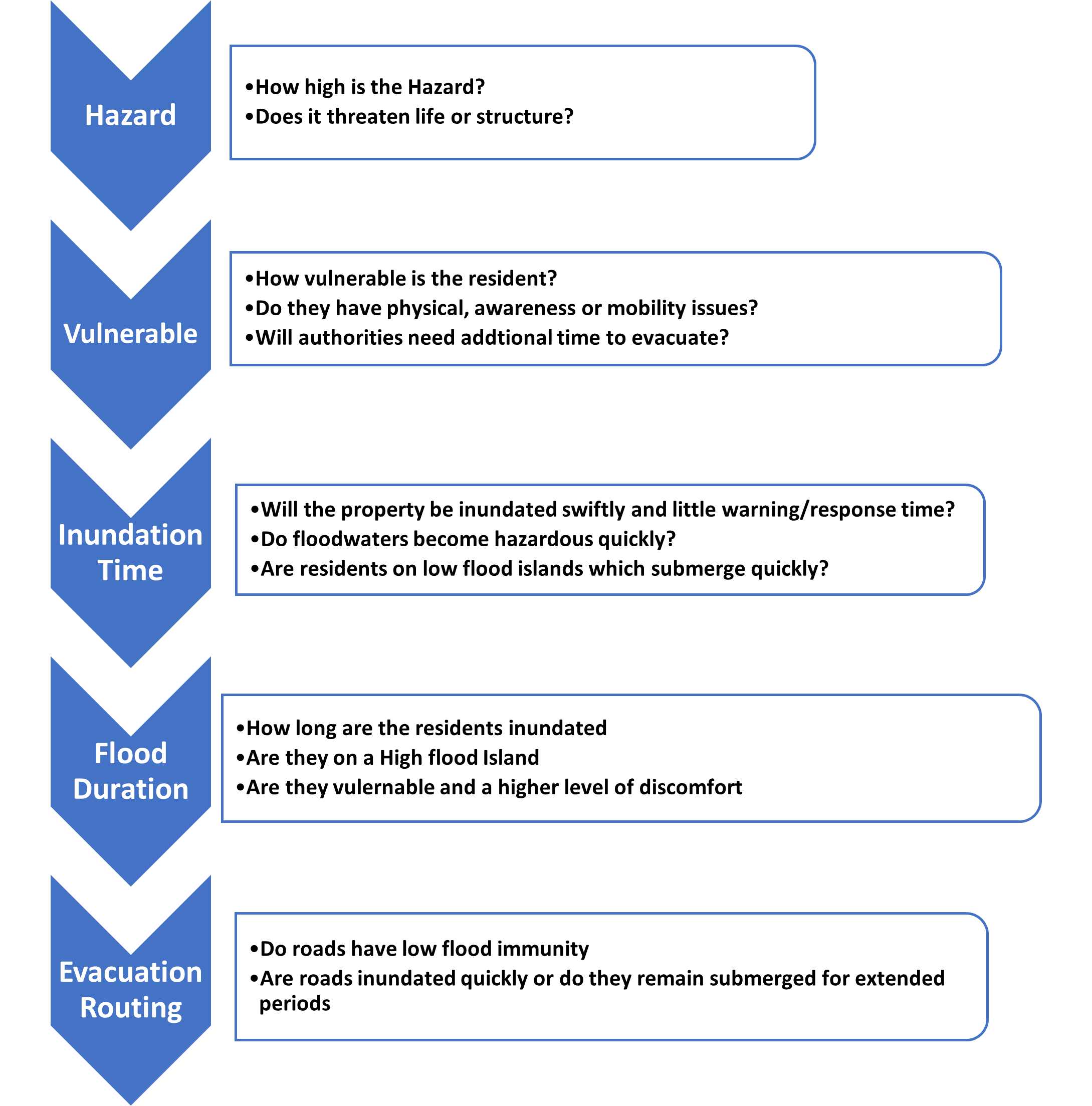
As part of this, flood risk and how it is defined and captured has also changed.  Not only has it changed, but it is now being captured in a way through analysis that enables contemporary approaches to management measures such as evacuation and flood resilient building materials (but to name a few)

As we all know, flood risk previously was defined as a single line on a map, evolving to understanding hazard in the mix and now a multitude of parameters are used to define holistic flood risk.

In the near future, we will highlight areas in how this information can be used in different areas of floodplain management.  The future is exciting in the FM space, and we are thrilled to be leading the charge in a new line of thinking.


Evacuation and Shelter in Place Assessment

Anybody who has been involved in an actual flood event will recognize that one of the issues in responding to these floods is the shear scale, complexity and lack of resources available.

Currently, understanding evacuation and sheltering in place is very difficult, perhaps until now.  Traditional assessments are based on the fact that when someone is flooded, there is an expectation to cater for evacuation.  But more often than not, trying to do that results in fatalities and has been proven to be far more dangerous in some circumstances.

So, what do we do?  We can’t evacuate everyone, its simply not possible for a variety of reasons.  So, we need to understand flood risk intimately prior to and during an event.  Rather than throwing a wide berth of a flood line and each property that line touches must be tendered to, we need to understand who can remain safely (with some level of discomfort for a short time) and who is at real risk of perishing.  In large scale flood events, authorities simply cannot get to everyone.

So the potential way to do this is by taking a triage style approach to managing flood risk.  Manage those that have fast inundation times, high hazard, potentially trapped on low flood islands and who are vulnerable.  They absolutely need to be evacuated as a priority.  Outside of those at risk of perishing, we are leaving those in discomfort to shelter in place – we also can’t forget that those people may be vulnerable and inundated for very long periods of time or trapped on high islands without supply as an example.

Shelter in Place

An approach such as this can help authorities priortise limited resources into the areas needed.  Couple with advanced flood impact based intelligence and forecasting systems, this can also provide innovative ways to undertake a risk based approach to managing flooding.

This is an evolving space in floodplain and emergency management, and as the tools, techniques and technology improve, we can get better at managing our flood risk with multiple tools.

Previous flood event

Synergy Projects

Synergy has been busy.  Very busy.  Because we are working on what we are good at and what we love, its a really awesome thing!!

Our last year we have worked on a range of projects across flood modelling, floodplain management and waterway health.  As some of projects are still current, we cant reveal much yet but here’s some of the examples we have been working on:

  • Multiple Flood Modelling Projects utilising latest technology and AR&R19 outputs.
  • Best Practice and contemporary floodplain management plans.  this space is exciting and we have been pushing the boundaries delivering on holistic floodplain management and new ways in thinking and implementing flood risk based planning, emergency management and flood mitigation outcomes.
  • Flood Forecasting and Flood Intelligence Projects
  • Integrated Water Plans, strategies and modelling outcomes
  • Flood Risk based planning projects that are moving past just frequency and hazard.  We are working with Councils to increase understanding and application of flood risk incorporating evacuation, time to and duration of inundation, cumulative fill impact assessments, floodplain management and master planning and delivering No Feasible Alternatives Assessment Reports.
  • Waterway health and water quality modelling and design outcomes and WSUD projects

Many of these projects push boundaries in a big way, innovative and some Australian and potentially world first applications.  We are really excited.  Our delivery also provides higher quality for lower costs whilst still pushing the industry forward and its because of our unique business model that we continue to deliver in this method.

As projects wind up we will be providing detailed overviews of these projects to give a depth of understanding of how everyone can benefit.

If you really want to push things forward in your area, please drop us a line and we can show you how!!


Catchment Award Winners!!

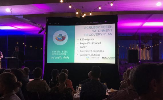
Synergy Solutions managed to pick up a joint award alongside our colleagues from Logan City Council, E2 Designlab, Lat27 and Catchment Solutions.

The project Scrubby Creek  Catchment Recovery Plan was a collaborative investigation and strategy to encourage better waterway health, ecosystems and community interaction with Logan’s waterways.

A fun part for us was seeing the communities of native fish in some areas you wouldn’t expect and how to bring more of them back.

A key role for Synergy was incorporation and integration of flooding aspects to the project but more importantly further development of our niche area and understanding of contemporary floodplain management and application of non structural measures.  Our understanding of flooding, waterway and catchment management and practical design aspects is what sets us apart.

This is where our company excels in these sorts of space, not just undertaking another flood modelling exercise.  Watch this space as some big, exciting projects are coming to light working in and around true integration of flooding and waterway health.


Natural Floodplain Management

Synergy Solutions have been involved in the Natural Floodplain Management (NFM) Space for a number of years.  We believe we are pioneers and early adopters of this practice in the Australian environment.

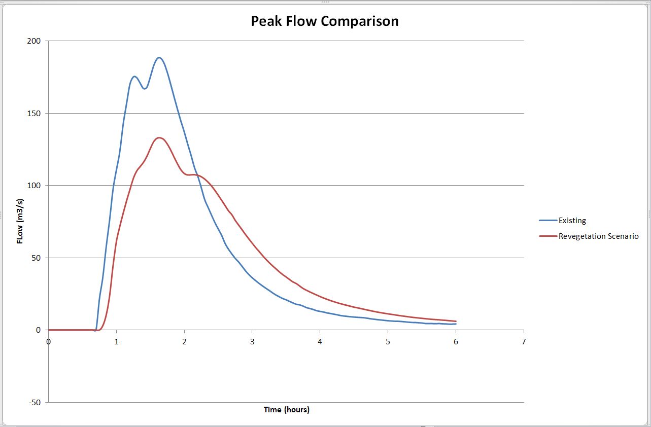
NFM is relies upon mimicking how our catchments use to be (similar to WSUD but at a larger scale) and maximising the use of natural approaches which can include riparian/floodplain re vegetation, infiltration increase, pilefields, woody debris, floodplain re-engagement and wetlands.

Traditional approaches to flood mitigation including dams and levees are fraught with issues not only from an environmental point of view but also the residual safety risk that is left for communities through over topping over defined flood events and failure.  The cost including maintenance can be very excessive.

Synergy have been working in the following areas:

  • At a local scale with farmers in adopting natural sequence farming techniques and tying links to larger regional outcomes.  We have actively worked on ground with several landcare groups on a not for profit basis and continue to do so
  •  Undertaking further research with universities to understand the increased infiltration in our catchments as a result of increasing vegetation cover.  Recent research suggests that heavily vegetated corridors and catchments are able to actively absorb up to 100mm/hour which drastically decreases surface runoff and thus flooding
  • 2D modelling incorporating NFM techniques which has shown major decreases in downstream flood levels/extents
  • Assisting local governments to provide grants, frameworks and scoping of NFM projects

Synergy will continue to invest more time commercially and NFP in this space as we firmly believe this is how floodplain and integrated water management should progress.  The benefits for flora/fauna, flooding and waterway health are enormous and will provide overall benefit for society in the long term.

As a business actively involved in this space and leading research and application, we encourage you to get in touch.  If you would like to find out more, gain access to more information or talk to us about application in your catchment please give us a call.


Follow us on Linkedin